|
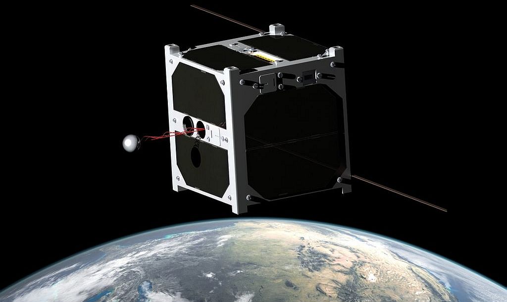
SATELLITES
ABOUT - CONTACTS - FOUNDATION - HOME - A-Z INDEX
Satellites will play an important part in the fight against marine litter. They can already identify oil spills to alert emergency response units to the latest pollution position for containment purposes.
We also use satellites for geopositioning, data sharing, navigation and communications. In short, satellites are now an everyday tool to enhance marine operations, surveys, monitoring or for exploration purposes.
All of this is only possible because of our launch capabilities, and all of that development came about because of space exploration and the space race, where large motors and fuel systems were developed by several countries to get heavy objects on earth, including humans, into space.
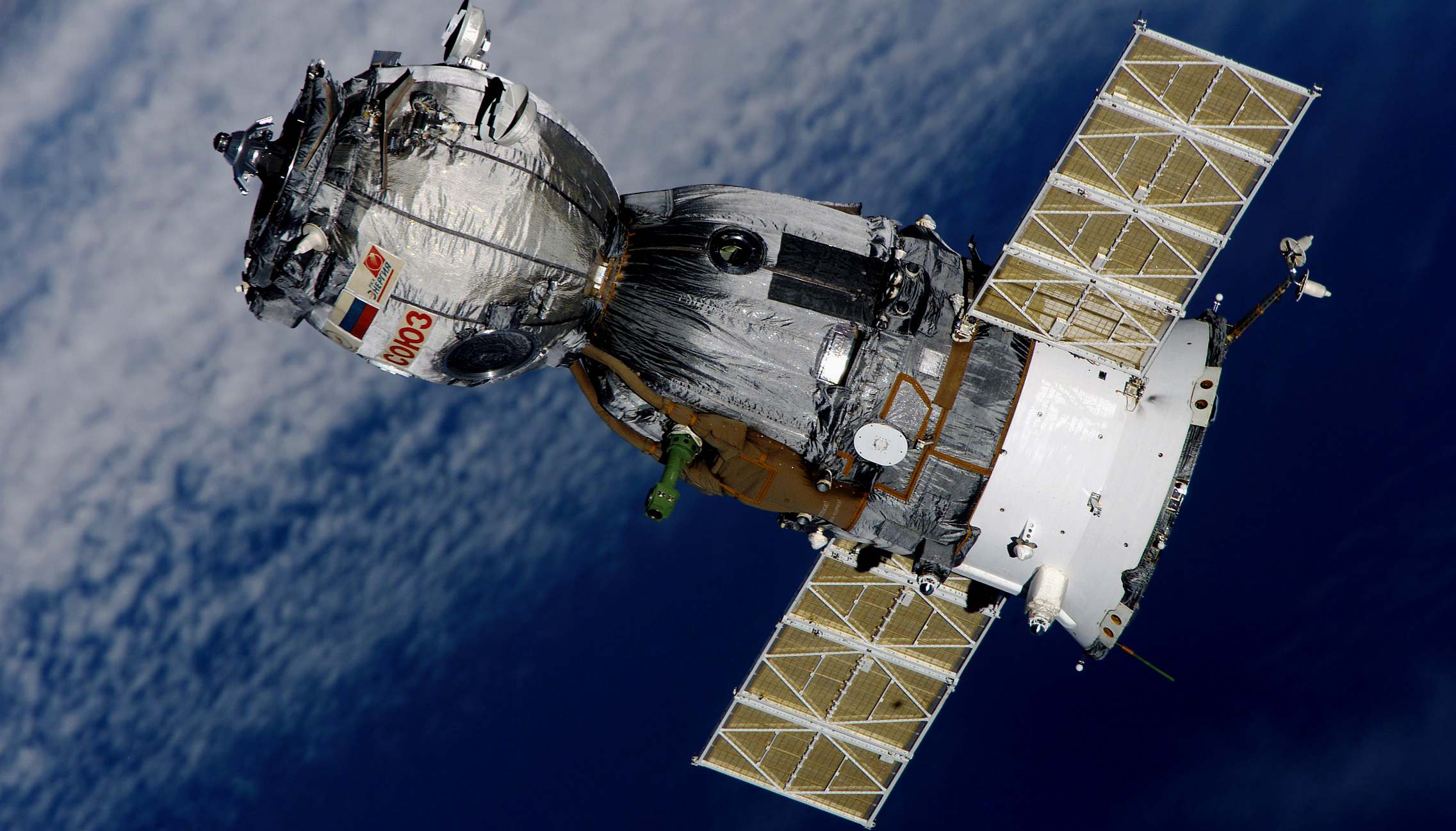
SOYUZ:
Soyuz is a series of spacecraft designed for the Soviet space program by the Korolev Design Bureau (now RKK Energia) in the 1960s that remains in service today. The Soyuz succeeded the Voskhod spacecraft and was originally built as part of the Soviet manned lunar programs. The Soyuz spacecraft is launched on a Soyuz rocket, the most frequently used and most reliable launch vehicle in the world to date. The Soyuz rocket design is based on the Vostok launcher, which in turn was based on the 8K74 or R-7A Semyorka, a Soviet intercontinental ballistic missile. All Soyuz spacecraft are launched from the Baikonur Cosmodrome in Kazakhstan.
In context of
space flight, a satellite is an artificial object which has been intentionally placed into orbit. Such objects are sometimes called artificial satellites to distinguish them from natural satellites such as Earth's
Moon.
SATELLITE HISTORY
The first artificial satellite was Sputnik 1, launched by the
Soviet Union on 4 October 1957, and initiating the Soviet Sputnik program, with Sergei Korolev as chief designer. This in turn triggered the Space Race between the Soviet Union and the United States.
In 1954, the Secretary of Defense stated, "I know of no American satellite program." In February 1954 Project RAND released "Scientific Uses for a Satellite Vehicle," written by R.R. Carhart. This expanded on potential scientific uses for satellite vehicles and was followed in June 1955 with "The Scientific Use of an Artificial Satellite," by H.K. Kallmann and W.W. Kellogg.
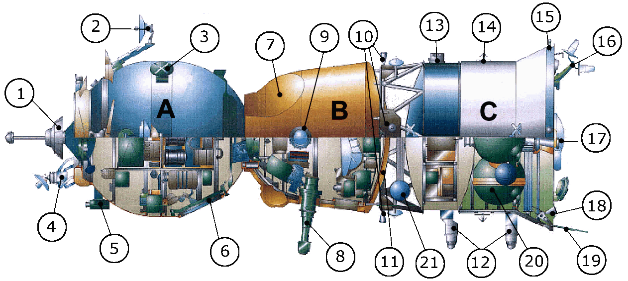
SOYUZ: The first Soyuz flight was unmanned and started on November 28, 1966. The first Soyuz mission with a crew, Soyuz 1, launched on 23 April 1967 but ended with a crash due to a parachute failure, killing cosmonaut Vladimir Komarov. The following flight was unmanned. Soyuz 3, launched on October 26, 1968, became the program's first successful manned mission. The only other flight to suffer a fatal accident, Soyuz 11, killed its crew of three when the cabin depressurized prematurely just before reentry. These were the only humans to date to have died above the Kármán line. Despite these early incidents, Soyuz is widely considered the world's safest, most cost-effective human spaceflight vehicle, established by its unparalleled length of operational history. Soyuz spacecraft were used to carry cosmonauts to and from Salyut and later Mir Soviet space stations, and are now used for transport to and from the International Space Station (ISS). At least one Soyuz spacecraft is docked to ISS at all times for use as an escape craft in the event of an emergency. The spacecraft is intended to be replaced by the six-person Federation spacecraft.
In the context of activities planned for the International Geophysical Year (1957–58), the White House announced on 29 July 1955 that the U.S. intended to launch satellites by the spring of 1958. This became known as Project Vanguard. On 31 July, the Soviets announced that they intended to launch a satellite by the fall of 1957.
SATELLITE USES
2. Bio-satellites 3. Atmospheric studies (Polar) 4. Communications, TV, Radio, Phones (Anik E) 5. Navigation (Navstar) 6. Reconnaissance/spy (Lacrosse) 7. Recovery 8. Remote sensing (Radarsat 9. Search and rescue (Cospas, Sarsat) 10. Space craft (Apollo, Shuttle) 11. Space exploration (Galileo) 12. Space stations 13. Weather (Meteosat)
THE SPACE RACE
The United States Space Surveillance Network (SSN), a division of the United States Strategic Command, has been tracking objects in Earth's orbit since 1957 when the Soviet Union opened the Space Age with the launch of Sputnik I. Since then, the SSN has tracked more than 26,000 objects. The SSN currently tracks more than 8,000 man-made orbiting objects. The rest have re-entered Earth's atmosphere and disintegrated, or survived re-entry and impacted planet Earth. The SSN tracks objects that are 10 centimeters in diameter or larger; those now orbiting Earth range from satellites weighing several tons to pieces of spent rocket bodies weighing only 10 pounds. About seven percent are operational satellites (i.e. ~560 satellites), the rest are space debris. The United States Strategic Command is primarily interested in the active satellites, but also tracks space debris which upon reentry might otherwise be mistaken for incoming missiles.
SPECIFIC TASKS
Satellites are launched into the space to do a specific job. It is an expensive undertaking that each autonomous vehicle has to be designed for and costed for economic viability.
WEATHER PREDICTION
Satellites are launched to monitor cloud patterns for weather stations and others to send television signals for Sky TV. Satellites are used for oceanography, astronomy, surveillance. They help scientists get a perceptive view of all kinds of objects anywhere in the world.
Earth observation satellites can monitor the ocean and wind currents, the extent of forest fires, oil spills and airborne pollution. Satellites provide meteorologists with the ability to see the weather on a global scale. They allow them to follow the effects of phenomena like volcanic eruptions and burning gas and oil fields, to the development of large weather systems like hurricanes.
OCEAN MONITORING
Ocean surveillance satellites are used to search for ships and submarines. They can spot nuclear vessels and new advancements may allow them to scan the depths of the ocean. Early warning and Elint satellites are primarily used by the armed forces to protect their countries from the sneak attacks. They can help to detect if other countries are building or storing nuclear warheads with varying degrees of success, because of course the opposing military are sure to employ decoys. This is all negative effort in terms of human endeavour where technology works for the preservation of life on earth positively.
Marine scientists and marine biologists can detect much that goes on in the ocean.
They use satellites to detect the oceans as they affect the environment,
even analyzing wave patterns.
Satellites can detect underground water and mineral sources. They can monitor the transfer of nutrients and contaminants from the land into the waterways and out to sea. They can measure land and water temperatures, the growth of algae in the seas and the erosion of topsoil from the land.
CLIMATE
CHANGE
AGRICULTURE
RESCUE
Satellites can take the search out of search and rescue
for people in the distress in the remote regions. Distress radio beacons directly linked to a search and
rescue satellite can lead rescuers quickly and
NAVIGATION
Satellites provide in flight phone communications on aircraft. They are the main conduit of voice communication for rural areas and areas where phone lines are damaged after a disaster. They provide the primary timing source for cell phones and the pagers.
The satellite based navigation systems like Navstar Global Positioning Systems enable anyone with a handheld receiver to determine his location to within a few meters ,They are known colloquially as GPS.
GPS locators are increasingly included in car direction services, replacing the skills of a good map reader. GPS based systems are used by civilians and the military for navigation on land, sea and air. They are crucial in situations like a ship making a difficult course to a harbor in bad weather or where troops may be lost in unknown regions.
COMMERCE
ASTRONOMY
Astronomy satellites are
new technology that are mounted on earth orbiting satellites or
in deep space
DECOMMISSIONING
When satellites reach the end of their mission (this normally occurs within 3 or 4 years after launch), satellite operators have the option of de-orbiting the satellite, leaving the satellite in its current orbit or moving the satellite to a graveyard orbit. Historically, due to budgetary constraints at the beginning of satellite missions, satellites were rarely designed to be de-orbited. One example of this practice is the satellite Vanguard 1. Launched in 1958, Vanguard 1, the 4th manmade satellite put in Geocentric orbit, was still in orbit as of August 2009.
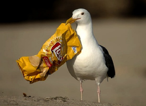
SEAGULLS: Satellites could help to prevent seabirds from eating plastic litter that pervades our beaches and oceans.
LINKS & REFERENCE
https://en.wikipedia.org/wiki/Satellite
This website is provided on a free basis as a public information service. Copyright © Cleaner Oceans Foundation Ltd (COFL) (Company No: 4674774) 2017. Solar Studios, BN271RF, United Kingdom. COFL is a charity without share capital.
|