|
CAPE HORN
ABOUT - CONTACTS - DONATE - FOUNDATION - HOME - A-Z INDEX
Cape Horn (Spanish: Cabo de
Hornos) is the southernmost headland of the Tierra del Fuego archipelago of southern Chile, and is located on the small Hornos Island. Although not the most southerly point of South America (which are the Diego Ramírez Islands), Cape Horn marks the northern boundary of the
Drake Passage and marks where the
Atlantic and Pacific Oceans meet.
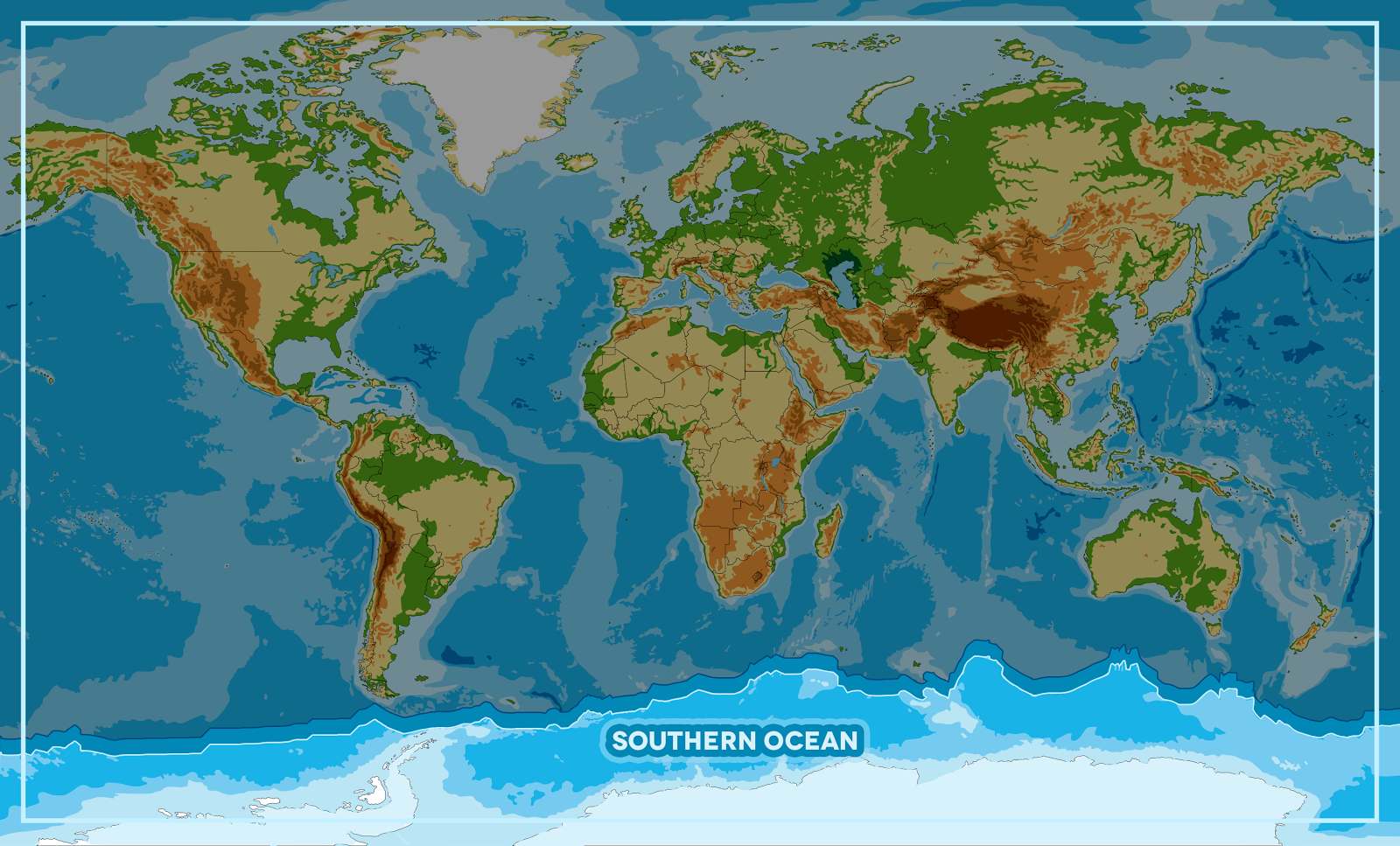
OCEAN AWARENESS CAMPAIGN - As part of the Cleaner Ocean Foundation's ocean literacy campaign, we are developing a game that can be played on mobile devices like the iphone or android smart phones. In this game children learn a little about geography as they select one of five ocean areas to rid of marine litter. The screen above shows that the player has selected the Southern Ocean to tackle. Copyright Map © January 29 2018 all rights reserved COF Ltd. Copyright Maps © January 29 2018 all rights reserved COF Ltd.
Cape Horn is one of three capes, included in the Jules Verne Trophy, the others being the Cape of Good Hope and Cape Leeuwin.
LINKS & REFERENCE
https://
AEGEAN - ACIDIFICATION - ADRIATIC - AMBRACIAN GULF - ARCTIC - ATLANTIC - BALTIC - BAY BENGAL - BAY BISCAY - BERING - BLACK - CARIBBEAN - CASPIAN - CORAL - EAST CHINA SEA ENGLISH CH - GOC - GUANABARA - GULF GUINEA - GULF MEXICO - INDIAN - IRC - IONIAN - IRISH - MEDITERRANEAN - NORTH SEA - PACIFIC - PERSIAN GULF - SEA JAPAN STH CHINA - PLASTIC - PLANKTON - PLASTIC OCEANS - RED - SARGASSO - SEA LEVEL RISE - SOUTHERN - TYRRHENIAN - UNCLOS - UNEP WOC - WWF
BIOMAGNIFICATION - BP DEEPWATER - CANCER - DDT - FISHING NETS - FUKUSHIMA - MICROBEADS - MICRO PLASTICS - OCEAN GYRES - OCEAN WASTE - PACKAGING - PCBS - PET - PLASTIC - POPS - SINGLE USE
This website is provided on a free basis as a public information service. copyright © Cleaner Oceans Foundation Ltd (COFL) (Company No: 4674774) 2025 Solar Studios, BN271RF, United Kingdom. COFL is a charity without share capital. The names Amphimax™ and SeaVax™ are trademarks.
|